

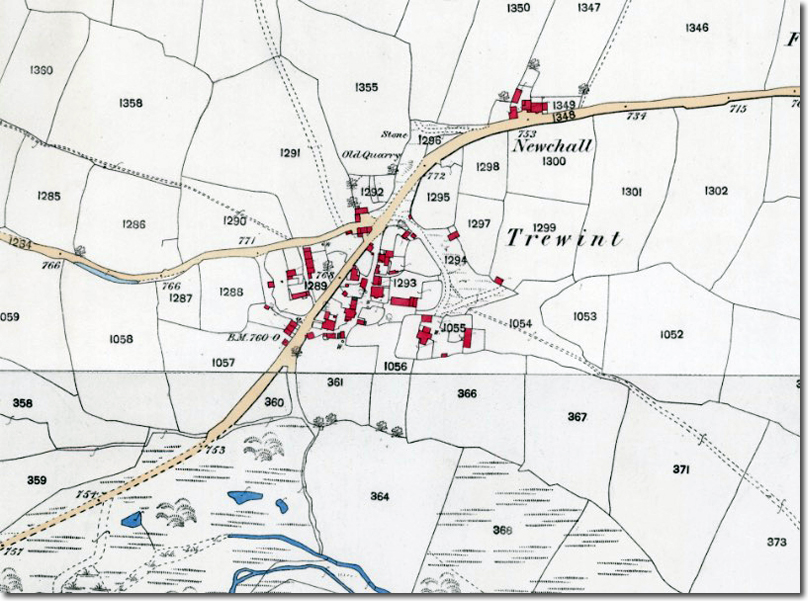
Trewint is a small hamlet in the civil parish of Altarnun, lying just southwest of the main village and set directly on what was, for centuries, the principal land route into Cornwall. Before the modern A30 bypass, every traveller heading west crossed the county boundary at Launceston and passed through Trewint on the long ascent towards Bodmin Moor. The Cornish name, Trewyns, meaning “windy farm”, reflects both its exposed position and the conditions that shaped the journey: this was the point where the sheltered farmland gave way to the open moor, a notoriously arduous stretch in poor weather. The hamlet appears in the Domesday Book of 1086 as a modest settlement of five households and one ploughland, valued at 5 shillings and held by Roger of Courseulles under Count Robert of Mortain.
Its most significant building today is Wesley Cottage, also known as Digory Isbell’s Cottage, an eighteenth‑century dwelling that became an early centre of Methodism in Cornwall. In 1743 John Wesley’s companions John Nelson and John Downes were given shelter here by Digory and Elizabeth Isbell, marking one of the first Methodist gatherings in the district. Wesley himself stayed frequently, prompting Isbell to build a small extension for him: the “Prophet’s Chamber”, consisting of two rooms for lodging, preaching and prayer. The lower room is regarded as the smallest Methodist preaching house in the world.
Trewint’s position on the main east–west route made it a natural stopping point for itinerant preachers, packhorse trains, and later stage‑coach traffic. The climb onto Bodmin Moor immediately to the west was one of the most challenging sections of any journey into Cornwall: exposed, weather‑beaten and often treacherous in winter. The hamlet’s linear form, following the line of the old road, still reflects this history of movement and passage.
The wider landscape around Trewint reflects both its agricultural past and Cornwall’s long association with mining. The hamlet lies within the Devon and Cornwall metalliferous district, and local gravel pits have produced cassiterite, quartz and wolframite — minerals linked to the Permian‑era granite intrusions that shaped the region nearly 300 million years ago. To the west rise Trewint Downs and the slopes of Hendra Down and The Beacon, where prehistoric enclosures, cairns and hut circles form part of an ancient moorland settlement pattern. These uplands also carry the first trickles of the River Lynher as it begins its descent towards the Tamar.
As part of the large Altarnun parish, covering over 15,000 acres, Trewint sits within a landscape shaped by farming, mining and religious revival. The 1795 Methodist chapel at Altarnun and the preserved Prophet’s Chamber at Trewint together illustrate the strength of the movement in this part of Cornwall. The moor rising behind the hamlet, and the old road running through its centre, together anchor Trewint in the long story of travel, hardship and hospitality on Cornwall’s eastern frontier.

